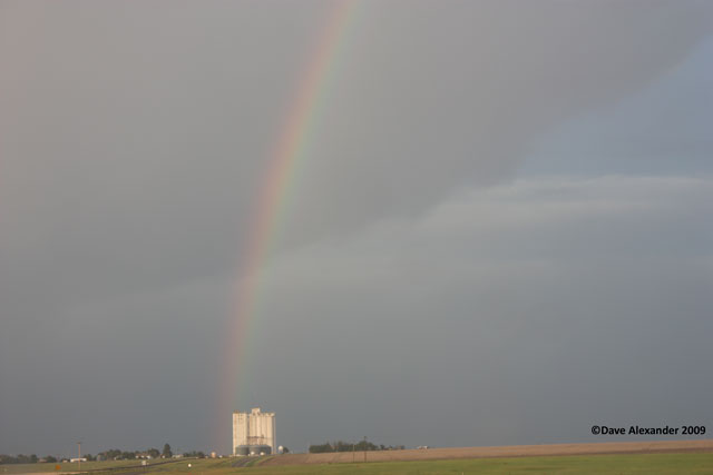
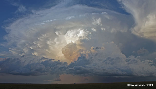
What a great day. Here is a chase log for the tornadic supercell that started in Larkspur! Saw two tornadoes and followed the storm into Western Kansas.
First and foremost, Happy Birthday Daphne!
There was a moderate risk issued by the SPC for much of Kansas today, and that was my initial target, but I got a late start as I was awaiting UPS to deliver my new HD Canon VIXIA HF-20 camcorder, I’ve been anxious to check this baby out! What a day to do it! Eastern Colorado was in a Slight Risk area. Note that at the end of this document I have a YouTube URL of some of the video footage I took, make sure and check that out too!
I left home about 12:30 and looking north I saw some awesome convection, so I immediately chose to go to my favorite spot about 10 miles east with a 360 view. The storm was definitely looking great and it was severe thunderstorm warned, here is what I saw from my house…
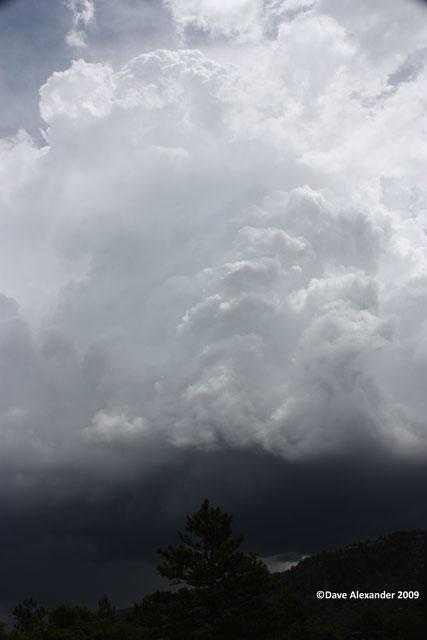
Here is what I saw when I got to my favorite spot…this is looking over west Parker.
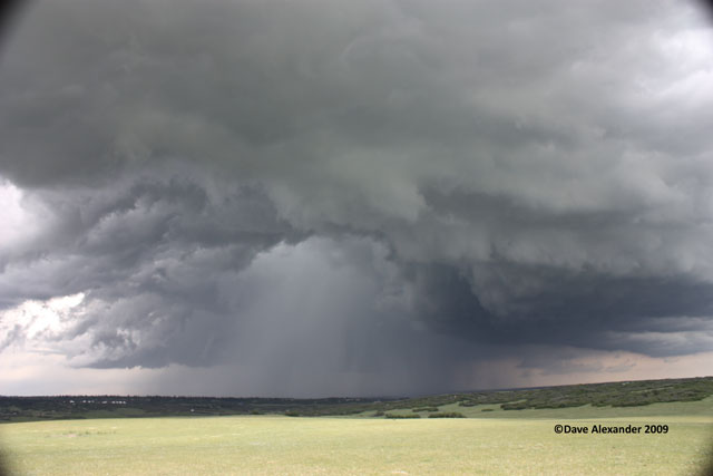
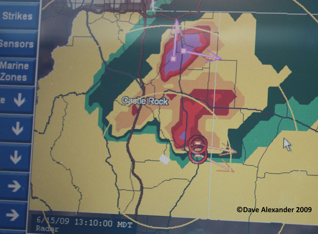
Again, the radar showed that this storm was Severe warned, my guess is for hail (as seen in the above picture) but I haven’t looked at the warning yet. Notice on the Baron unit that it shows some rotation on the southern section of the storm, about 5 miles to my east (I’m the little white car in the center of the radar, the “yellow rings” denote 10 miles radius from my GPS location!!
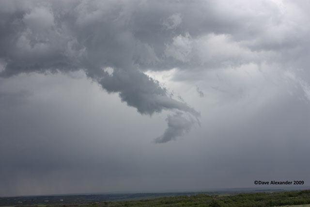
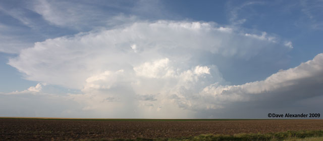
Then, out of the northern section of the storm this formation formed. It was not really rotating, at least not enough to get excited about, but it was really cool looking! I got the tripod setup and the camcorder recording. I have some great footage of this formation (time lapsed it is awesome) of the storm.
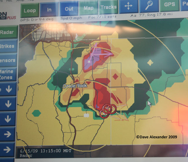
Meanwhile, looking back at the radar, the southern end of this storm was really starting to churn. Could this be a lucky day to see a tornado? I was hopeful at this time! Still no tornado warning or watch box, both that would be issued in the next 30 minutes.
Then, I noticed the rotation in the southern flank of the storm. It started just below cloud level and creeped down towards the ground. It was about 6-7 miles away at this time. I called the NWS at this time to report a funnel cloud and the intense rotation. This was taken at 1:28pm. So far, I’m about 7 miles from home on this chase! 😉
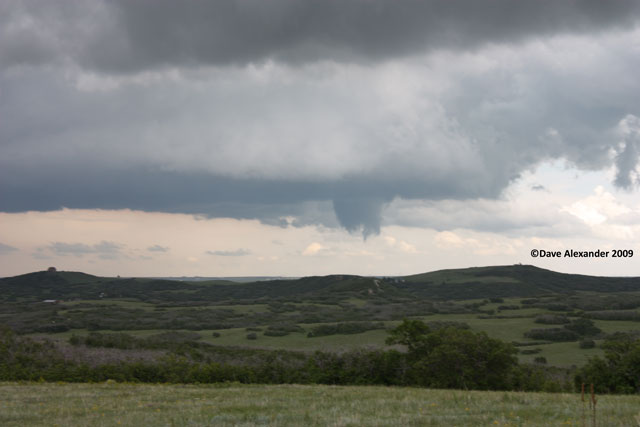
Slowly but surely the funnel took a typical funnel shape. This reminds me of the funnel I saw in the Badlands of South Dakota in 2005 and the one in extreme SW Nebraska on June 1 this year. I couldn’t confirm that it was on the ground yet, though, as the hill was in the way, so I was still calling this a funnel.
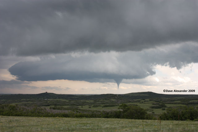
The funnel slowly started to get bigger so by this time it was nice and fat. I can’t confirm if it was on the ground yet or not. I was hearing eye-witnesses at the time on the radio saying it was a HUGE tornado. All I can say it was taking its time and it was something amazing to watch!
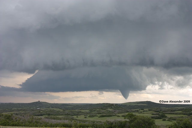
Guessing, I would say it is on the ground now. This shot was taken at 1:40pm.
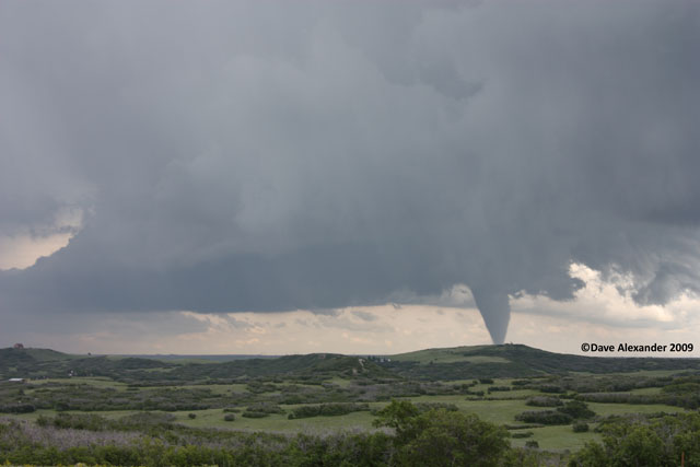
It is definitely on the ground now, I can see the debris cloud. This was taken at
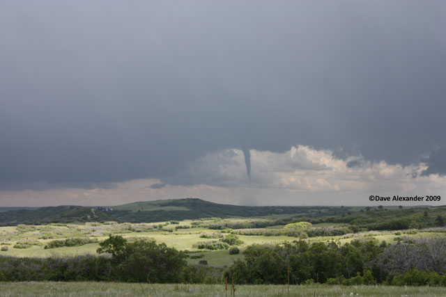
Yet another look at the tornado as it was bouncing up and down from within the cloud, but the whole time I observed debris swirling on the ground even though at times I couldn’t even see a funnel!
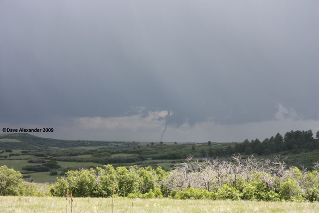
The tornado went out of view because of the rain and thus forced me to actually chase this storm! 😉 I jetted down to HWY 83 and then east on my favorite back roads towards Elbert. At one point when there wasn’t buttes in the way I could see a rotating funnel.
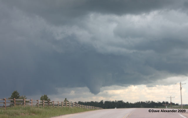
Then this funnel occluded and another tornado formed just to the NE of it. I had one better view of the tornado just before this, it was a bit fatter but driving and taking a picture I haven’t mastered yet, so I only got the clouds above it.
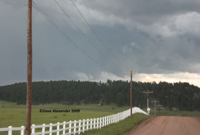
I met up with a couple of first time chasers about this time and we drove out to HWY 24. This was taken before Calhan, there was definitely rotation still going on, visually and also on the radar.
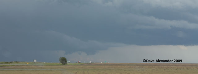
Here’s another wall cloud that was forming right off the road to the SE of me! Strong rotation but no funnel.
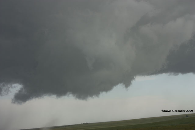
So I followed this storm all the way to Kansas as it was really the only storm within range and proven itself, why leave it. At Burlington I had to punch through the storm and I figured now was my chance or the storm would get south of me (bad viewing from the North side) in VERY rural Western Kansas where there was limited road access. Plus the storm had passed the dryline and was getting into much more instable air. The supercell took on a whole different shape and life at this point. As I came out of the storm this is what I saw looking south. Notice the green “veins”, I’ve never seen this before, it was beautiful structure. I stopped at the rest area to get some better shots, but the storm was picking up speed and the hail I went through was likely getting bigger, so there was no time to take pictures at this time. Note that this storm had been tornado warned pretty much solid since Elbert County, although I didn’t see any tornadoes with it. The shot was taken at 6:27 pm MDT.
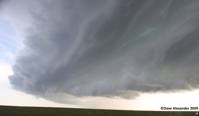
I got to Goodland and headed south. As soon as I was far enough out of town I had to stop and take some pictures of this amazing supercell structure! This shot was south of me, you can see the other chasers (smartly) trying to beat the hail coming.
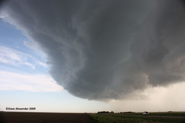
This is right in front of me (notice the STOP sign, really appropriate this day!), and after getting a quick shot with my camcorder I headed south again. Unfortunately the storm was completely changing and reforming at the time and I ended up getting into the hail core. It was like a hurricane, the winds, totally horizontal, and the hail coming down looked like waves on the road…no joke. Am I in a hurricane in Western Kansas?
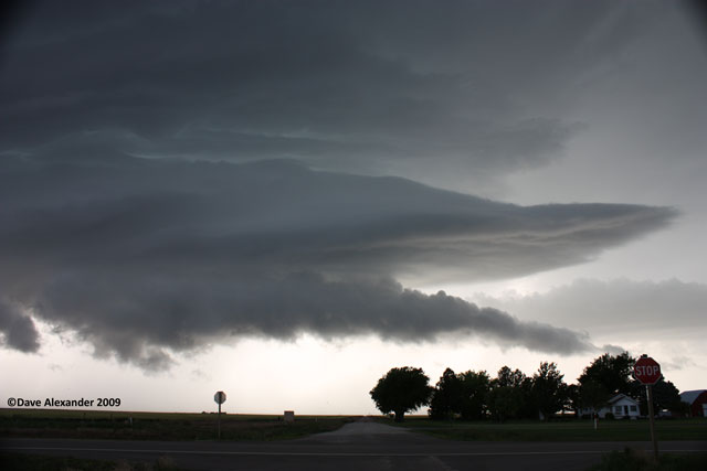
Shortly I was out of the precipitation and I had to decide if I was going to try and go north again and catch the wrong side or the storm, or head south and parallel it. Since the storm motion was ESE I decided to get a little south of it and then take the diagonal HWY 40 out of Sharon Springs. I decided to do the south route in hopes of getting some good view of storm structure, which I did. Nice beaver tail action on this baby!
The southern end of the storm that was so intense just 30 minutes before was quickly fizzling out as it intercected my HWY 40 route. I took State Road 25 north to Colby in one last effort to catch the intense part of the storm. Then decided it was time to head home as I didn’t feel like staying out too late (had to work in the morning) for lightening shots, plus these storms were moving quick.
I guess “gold” in western Kansas is grain, which these rural towns are built upon, as I discovered in this shot.
Goodbye Storm!
I have some pretty neat footage that I’ve made available on YouTube in High Definition as I got some footage that was completely different than all the footage I’ve seen thus far from this storm.
http://www.youtube.com/watch?v=ybLaHLf2wVA
Overall, 13 hours on the road, about 660 miles. My 4th day this season chasing.

